A Roadpass Pro membership unlocks premium features on Campendium and our full featured partner app, Roadtrippers.
Here are the great benefits you’ll get with Pro while using Campendium:
1. No More Ads
While we love our advertisers, we must admit banner ads can be distracting from the content that we all want to focus on. If you are not a Roadpass Pro Member, you probably see a bunch of ads on this page.
When you are a Roadpass Pro Member, the only thing you need to do is log in to your account to make those pesky ads go away.
2. Filter by Reported Cell Service
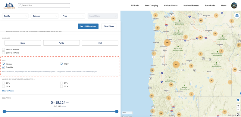
When someone writes a review on Campendium, they can also report how many bars of cell service they had at that location. All users can see that data on the campground detail pages, but what if you wanted to know earlier in the search process if people had usable cell service at a location? Well, Roadpass Pro Members can do just that by filtering their search results. Current carriers include Verizon, AT&T, and T-Mobile.
Learn More
3. Filter by Elevation
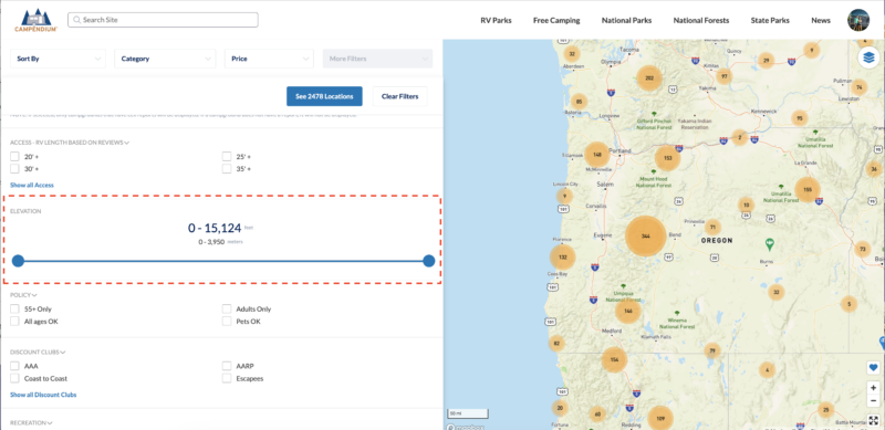
Filtering by elevation is useful if you are looking to go to higher ground for cooler temps in the summer or the opposite in the winter. Some people find it hard to breathe at higher elevations or may have other health concerns and wish to steer clear of locations over a certain elevation.
Learn More
4. Coverage Maps

In addition to cell service reports from Campendium reviewers, Roadpass Pro Members can view an overlay of the Verizon, AT&T, and T-Mobile coverage maps on the search results page! Simply navigate to the search results page on the Campendium website, click on the cell bar button in the bottom right corner of the map and select the carrier(s) you would like to see.
Wireless service providers’ network coverage map data is provided courtesy of the Federal Communications Commission. Data is for general information purposes and “actual coverage may vary.” You should be aware that service breaks can occur even in areas that appear to be covered.
Learn More
5. Public Lands Maps
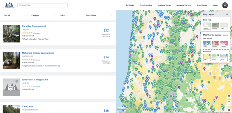
When planning to camp on public land, sometimes it’s nice to see the boundaries. Navigate to the search results page on the Campendium website, click on the public button in the bottom right corner of the map and select the public agency you want to see.
Public lands map data is provided courtesy of the National Park Service, National Forest Service, Bureau of Land Management, and Arizona State Trust Land. Data is for general information purposes only. Please note that private land may appear within a public land overlay. Please contact the appropriate management office to verify boundaries.
Learn More
6. Smoke Maps
iOS & Android app
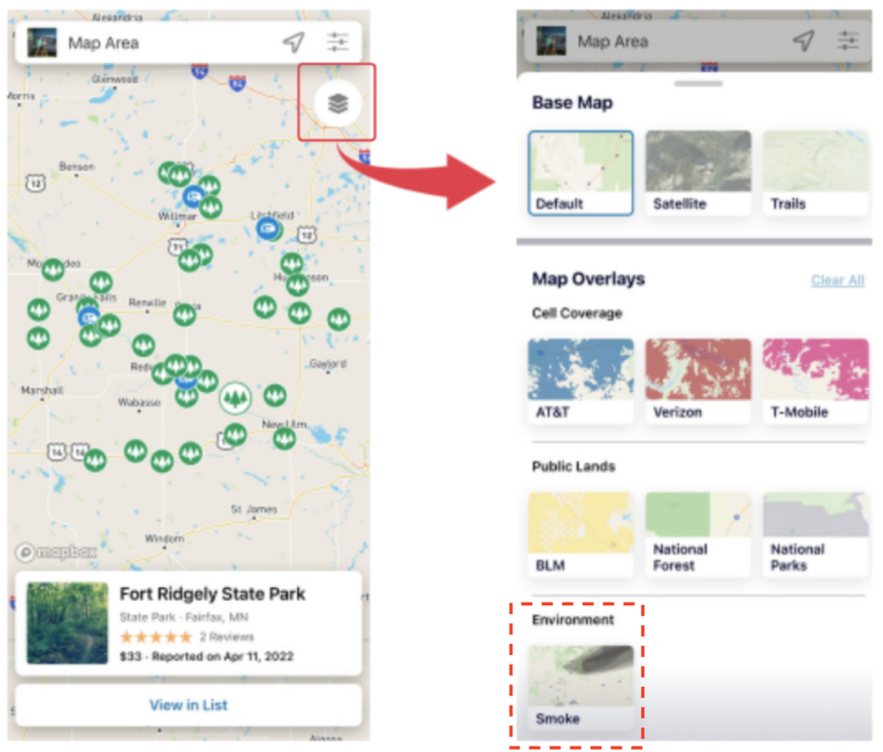
The Smoke Map feature allows campers to check for wildfire smoke conditions in the areas they’re planning to travel to in real time.
Selecting the Smoke overlay offers a way to monitor smoke conditions while planning for your next campsite – or knowing when it’s time to leave your current campsite. Light, medium, and heavy smoke coverage are contained in a single overlay. Smoke maps are only available on the iOS and Android apps. While smoke maps are updated regularly, wildfires and smoke spread rapidly. Do not rely on overlay map for precise coverage. Contact local authorities for the most up to date information and advice.
Learn More
7. Favorites on Search
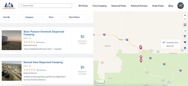
You can save campgrounds to your favorites by clicking the heart on the campground page. All users can view them in their profile, but only Roadpass Pro Members can see them on the search results pages.
Learn More
8. Trail Maps
website only
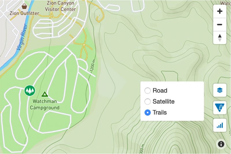
Have you ever wondered if there was a hiking trail near your campground? Roadpass Pro Members can now turn on trail maps by clicking on the new layer icon. (Hint: On search results pages you’ll need to zoom in to see trails).